Adding Overlays in Google Earth

3.00 Getting to Know Overlays
Wednesday, September 9, 2009
This tutorial steps through how to place an overlay in Google Earth. Before beginning, it’s helpful to know some things about overlays, and there are some things that are helpful to do to get ready.
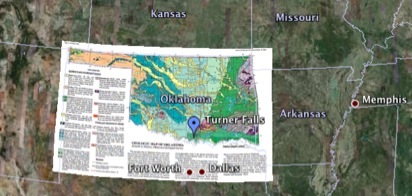
Here’s a Google Earth file that has just the Oklahoma Geologic Map overlay. This tutorial begins with exploration of overlays using this file. You can download it or use any other Google Earth overlay that you’ve already downloaded or created.
If you’re dying to jump ahead and start fiddling with how to make overlays, click on the overlay button in the Google Earth Toolbar:
Figure 1. The ‘Add Image Overlay” button in the Google Earth Toolbar is circled in red.
---------------------------------------------------------------------------------------------------------------------------------------------------------------------------------------------------------------
A Bit About Overlays:
In the picture at the top of the page, a geologic map of Oklahoma is overlain in Google Earth. Figure 2, zooms in to show part of the Southern and Eastern edges. The overlay has been made partially transparent. In this case, that allows you to see how the mapped geologic units are visible in the satellite imagery. This is particularly evident at the Eastern edge, where the folds shown on the geologic maps match the lay of land.
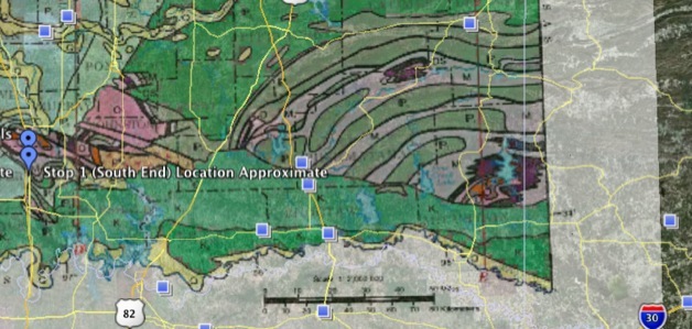
Figure 2. Looking through an overlay.
---------------------------------------------------------------------------------------------------------------------------------------------------------------------------------------------------------------
An overlay’s transparency is easily adjustable -- a slider bar below the ‘Places’ window on the left appears when overlays are highlighted. Figure 3, below, highlights some more things to notice when you work with overlays.
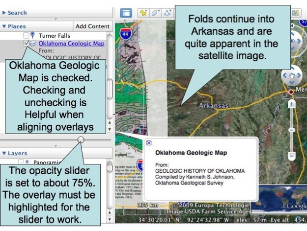
Figure 3. Exploring an overlay.
---------------------------------------------------------------------------------------------------------------------------------------------------------------------------------------------------------------
The most time consuming part of placing overlays in Google Earth is aligning them. (We’ll get to this in part 3.02). Checking and unchecking the overlay turns it on and off and sliding the opacity slider changes the image from opaque to clear. Both of these abilities make aligning images easier.
Overlays aren’t just used for maps. They can also be used to place map keys, satellite weather or fire photos and more.
ADDING OVERLAYS IN GOOGLE EARTH
Google Earth Files Used in Tutorials:
TUTORIALS: